SGNav
Navigation & Flight Path Data Acquisition
for Airborne Surveying
SGL has developed a flexible and simple navigation
system, SGNav, specifically designed for the
airborne geophysical environment. The system uses the
high accuracy of the GPS system and a navigation computer
to allow precise navigation in three dimensions anywhere
in the world.
SGL's SGNav system steers the crew from their
point of departure to the start of a specific line,
directs them along the survey line, and then to the next
line or any other specified line. At the end of the
flight, the crew will be guided back to the airport.
While flying along a line the SGNav system shows
the pilots the correct x, y location to fly as well as
showing them the correct altitude to fly based on a number
of altitude sensors.
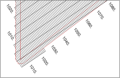
Sample of flight planning
generated by our software and fed into aircraft
navigation system
The position information is presented to the pilots on a
small flat panel LCD screen mounted in the pilot's line of
vision. The SGNav screen also shows the pilots
the altitude profile of the line and their position on
this profile. SGNav can also be used with a
pre-planned drape surface providing aircraft altitude
guidance in the survey area.
The SGNav system registers the aircraft flight
path by recording the raw GPS measurements. The raw
measurements, together with the measurements taken at a
ground station, are processed post-mission using the
kinematic GPS positioning program GPSoft. GPSoft uses a
robust U-D factorized Kalman filter to process
double-differenced observations which provides extremely
accurate differentially corrected GPS flight path
recovery.
The basic SGNav system consists of the following
items:
-
Airborne GPS Receiver and Aircraft Antenna
- NovAtel GNSS (Global Navigation Satellite System)
which incorporates GPS and other satellite
positioning systems, sampling rate of 20 Hz
- In-flight positional accuracy of better than 5 m
- Post-processed positional accuracy of better than
1 m
- Power requirement: nominal 10-35 VDC 10 watts
-
Airborne Navigation Control and Flight Path
Recording Computer
- Provides three-dimensional steering information on
a graphical display
- Records the position of the aircraft and the raw
GPS satellite range data necessary for post-mission
differential processing at up to 10 Hz
- Real-time differential GPS position corrections
for 2-5 m accuracy in-flight
- Send UTC time and/or timing pulses to a camera or
data acquisition system
- Data are recorded on removable storage media which
are dependable in high vibration environments
- The computer, designed for airborne use, operates
on 28 VDC, 60 watts
- RS232, optionally ARINC or RS422 data port
- Great circle, UTM or rhumb line flying
-
Post-Flight Software
- Enables the crew to list or view the recorded GPS
- This software can be run on any PC computer,
including the airborne computer
- GPSoft - post-mission differential GPS positioning
software
-
GPS Reference Station for Differential GPS Position
solutions
To take the advantage of the maximum accuracy of the GPS
System, the following is needed at the ground reference
station site.
- NovAtel GNSS receiver
- Standard PC computer
- SGL's ground station recording software to record
the data from the receiver
SGL conducted an extensive study to compare actual flight
paths flown using raw GPS data, and flight paths flown
using real-time corrected GPS data, against the
pre-planned track and altitude. Based on this study, we
are convinced that there is no longer any advantage in
using real-time differential corrections, and there are
many surveys where it will actually hamper the crew's
ability to follow the pre-planned flight lines. We
therefore prefer not to use real-time differential
corrections for navigation, and we continue to
differentially correct all of our GPS post-flight using a
local GPS reference station. Differential GPS receivers
can be used to provide real-time differential corrections,
if required.
Various GPS receivers were reviewed and the NovAtel GNSS
receivers were found to be the most suitable for this
application. These multi-frequency receivers incorporate
GPS and other satellite positioning systems. Real-time
differential navigation is also possible with the SGNav
system.
The recorded reference GPS measurements, together with
measurements recorded on the aircraft, are processed after
the flight using SGL's GPSoft kinematic differential GPS
processing program.
Navigation and Flight Path Recovery Systems
The SGNav navigation system can be configured to
provide pilot guidance in any of the following manners:
- Raw GPS data
- Real-time DGPS with corrections from a satellite
service
All the normal navigation parameters are displayed on the
miniterminal, such as:
DTW
distance to waypoint |
TMG
track made good |
TTW
time to waypoint |
DFW
distance from waypoint |
SPD
aircraft ground speed |
TTS
time to start of line |
DTS
distance to start of line |
XHT
up/down error |
TTE
time to end of line |
DTE
distance to end of line |
DTK
desired heading |
TKE
track error |
In addition to this, the number of satellites being used,
PDOP and various other parameters of the GPS system are
displayed.
SGNav Performance Specifications
-
Differential Position:
-
The accuracy achieved by this method is better than 1
m.
-
Single Receiver Position:
-
The accuracy achieved without differential correction
is better than 5 m.
These specifications are given assuming that the GPS
receivers are tracking a minimum of four satellites, with
good satellite geometry.
|