-
SERVICES
- Gravity » AIRGrav
- Marine AIRGrav
- Magnetic Total Field
- Magnetic Gradient
- Radiometrics
- Frequency-Domain EM
- Geoid Applications with AIRGrav
- Scanning LiDAR
- Methane Sensing
- Multi-Parameter Surveys
- Environmental Monitoring
- Baseline Monitoring & Contamination Detection
- Data Interpretation
- Navigation » SGNav
- Drape Flying » SGDrape
- Quality Control
 |
|---|
 |
 Geoid Applications with AIRGravSander Geophysics Limited (SGL) has been acquiring airborne gravity data since 1999 using AIRGrav, Sander Geophysics’ purpose-built airborne gravimeter. SGL has been involved in research related to using airborne gravity for geoid modelling for over 20 years. In the last 15 years, SGL has used airborne gravity data acquired with AIRGrav to evaluate and improve geoid models all over the world. 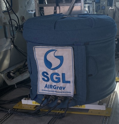 Geoid computations are performed using the remove-restore technique with the long wavelength contributions of the gravity field modelled and removed using an earth gravity model such as EGM2008 or one of the newer GOCE models, and the short wavelengths removed by computing the gravity effect of the residual terrain/bathymetry using the best available digital terrain model (DTM) and digital density model (DDM). The geoid computations will be effected by integration with the Stokes' kernel using FFT techniques, and the gravity model and indirect effects of the topography will be restored to generate the final geoid. In order to verify the accuracy of the computed geoid, any available benchmarks in the area that have both orthometric heights determined by levelling, and GPS coordinates, can be used. Horizontal Gravity ComponentsThe resolution achieved from all three gravity vector components (x, y, z) from AIRGrav are better than any known commercially available system. The horizontal components are particularly useful for geodetic purposes, both for directly determining the short and medium-wavelength deflections of the geoid, and for checking the computations of the gravimetric geoid based on the vertical gravity data alone. 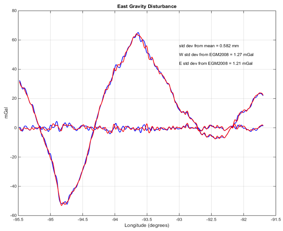 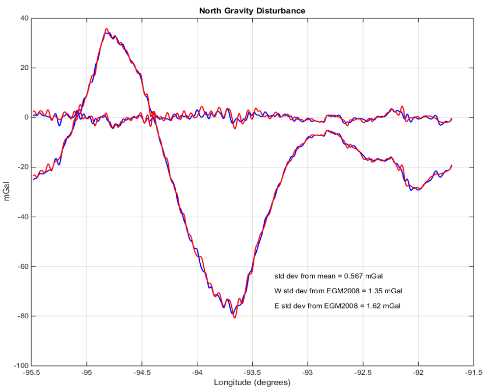 Table 1: East gravity component comparison with reference data. Filters are defined as half wavelength
Table 2: North gravity component comparison with reference data. Filters are defined as half wavelength.
Direct integration of the horizontal components along a flight line over the National Geodetic Survey's Iowa test line, GSVS14, results in agreement with GPS/leveling to better than 1 cm (IAG_IASPEI_2017_slidesWYM_SF1.ppt). SGL is also developing, along with academic research partners, a new method of performing geoid computations incorporating measurements of the full gravity vector, which has not been done routinely in the past due to lack of suitable data. Results to date show that the accuracy of a geoid computed using vector gravity measurements at a 10 km line spacing is equivalent to one computed using only the gravity magnitude measured at a 5 km line spacing. This considerably reduces the cost of flying surveys for geoid purposes, which are already more economical than ground surveys for the purpose. Vector gravity data acquired in a mountainous area of Colorado show that a geoid accuracy with a standard deviation of 2 to 3 cm compared with GPS/leveling points can be achieved using the airborne vector measurements alone. Airborne Gravity Experience at SGLSander Geophysics employs over 40 geophysicists and data processors who are experienced in processing and evaluating gravity data, as well as several subject-matter experts who specialize in positioning, geodesy, inertial platforms, and gravity, supporting SGL’s ongoing gravity projects as well as conducting research and development. SGL also collaborates with several world-renowned geoid experts. Worldwide Sander Geophysics has flown over four million line kilometres of airborne gravity surveys with AIRGrav, SGL’s industry-leading airborne gravimeter, with over one million line kilometres flown for geoid improvement. The same qualities of the AIRGrav system which allow SGL to offer consistent high quality airborne gravity for exploration purposes, also improve the productivity of the company’s geoid surveys. Key Advantages of using AIRGrav for Geoid Improvement
|